Go To GIS
POSM Central provides a Go To GIS link for customers configured to use POSM Central GIS.
POSM Central GIS is currently a separate web application with its own user accounts and sign-in process.
Open POSM Central GIS From Central
-
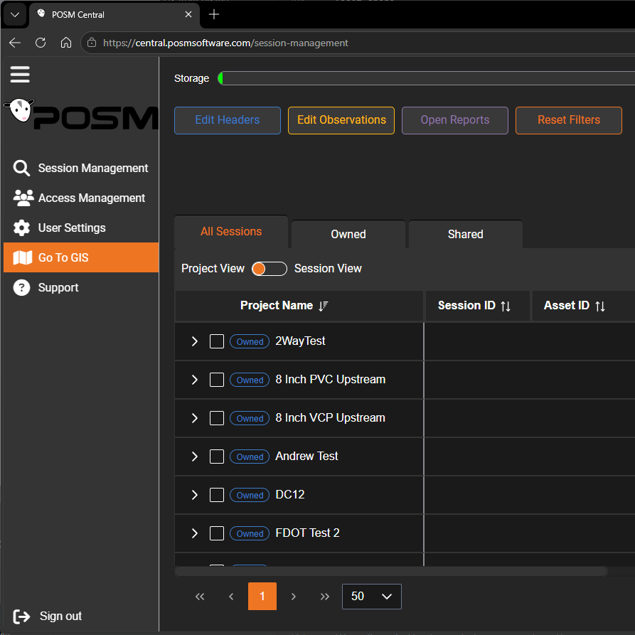
Sign in to POSM Central.
-
Select Go To GIS from the left navigation menu.
-
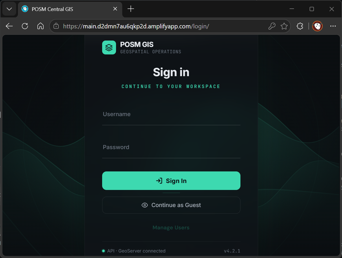
The POSM Central GIS website opens.
-
Sign in using your POSM Central GIS username and password.
-
Select the appropriate GIS workspace when prompted.
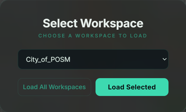
If your account has access to only one workspace, POSM Central GIS may load that workspace automatically.
Separate POSM Central GIS login
POSM Central and POSM Central GIS currently use separate sign-in systems.
The Go To GIS link opens POSM Central GIS but does not currently sign you into the GIS application automatically.
POSM Central GIS Workspace
When POSM Central GIS opens, the organization's configured GIS information is displayed on an interactive map.
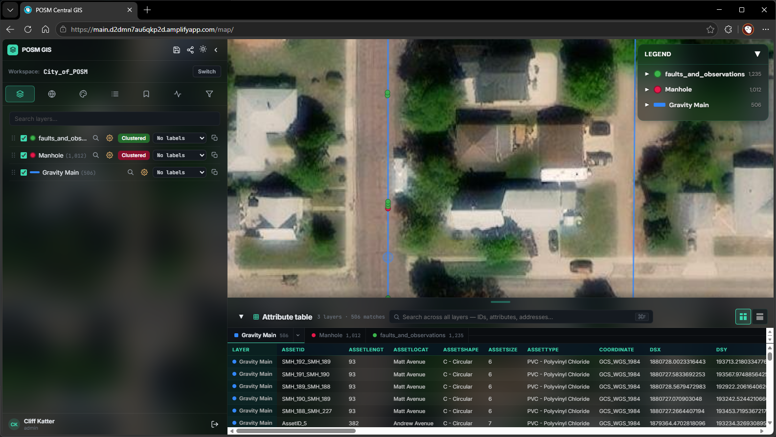
The GIS workspace contains three primary areas:
- Left Panel — map tools and GIS controls
- Map — interactive display of the organization's GIS assets
- Attribute Table — searchable GIS data at the bottom of the workspace
A collapsible Legend is also displayed in the upper-right corner of the map.
Left Panel
The left panel provides access to seven GIS functions:
- Layers
- Basemaps
- Symbology
- Legend
- Bookmarks
- Work Orders
- Advanced Search
Select an icon at the top of the panel to switch between functions.
Explore POSM Central GIS Features
Layers
The Layers tab controls which GIS information is visible on the map.
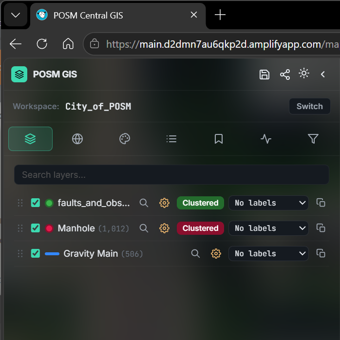
Use the checkbox beside a layer to turn that layer on or off.
Depending on the organization's GIS configuration, layers may include information such as:
- Gravity mains
- Manholes
- Faults and observations
- Other customer GIS data
The Layers panel also provides controls for applicable functions such as:
- Reordering layers
- Zooming to a layer
- Opening Layer Settings
- Clustering point features
- Displaying labels
- Duplicating layers
Note
The available layers and controls depend on the GIS data configured for your organization.
Change the Basemap
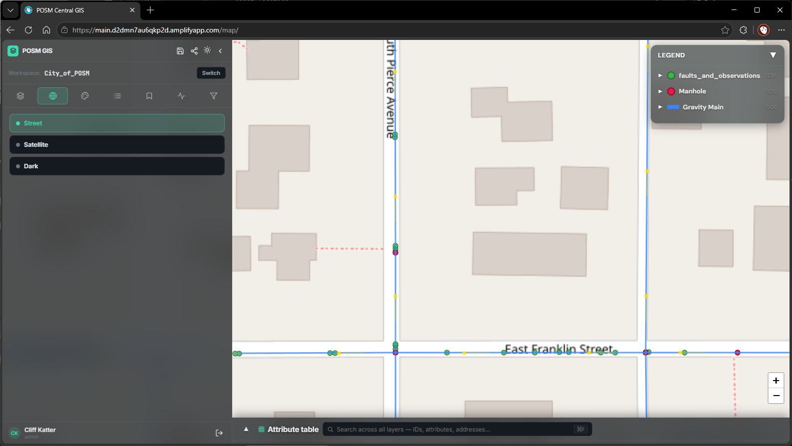
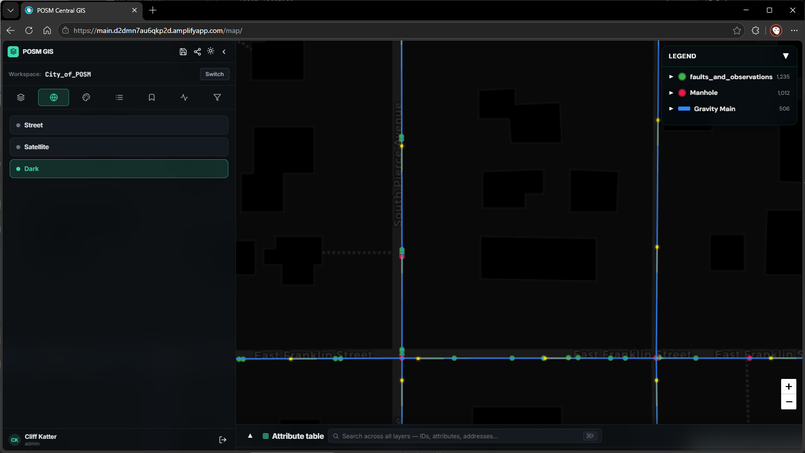
Use the Basemaps tab to change the background map.
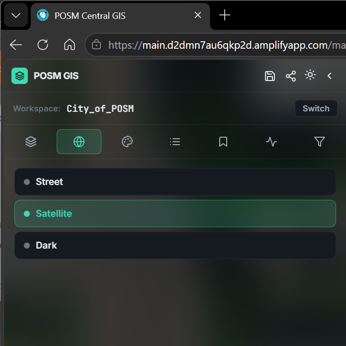
Available basemaps include:
- Street
- Satellite
- Dark
Changing the basemap does not change the organization's GIS asset data.
Satellite
Street
Dark
Legend
A collapsible Legend appears in the upper-right corner of the map.
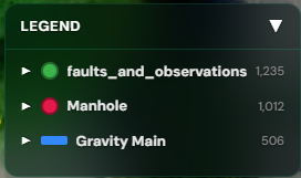
The Legend identifies the visible GIS layers and the symbols used to represent them.
Use the arrow beside a layer to expand or collapse its legend information.
The entire Legend can also be collapsed to provide additional map viewing space.
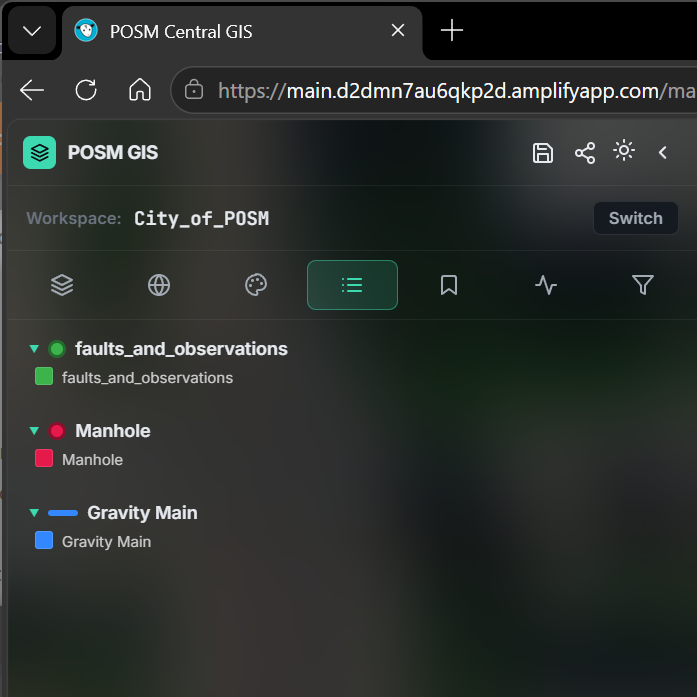
The Legend tab in the left panel provides another view of the GIS layer symbols and classifications.
Attribute Table
The Attribute Table appears along the bottom of the GIS workspace.
It displays GIS records and the attributes associated with them.
Depending on the GIS data, the table may contain information such as:
- Asset ID
- Asset length
- Asset location
- Asset shape
- Asset size
- Asset type
- Coordinates
- Other customer GIS fields
The exact columns depend on the organization's GIS configuration.
Search the Attribute Table
Use the search field in the Attribute Table to quickly locate GIS information.
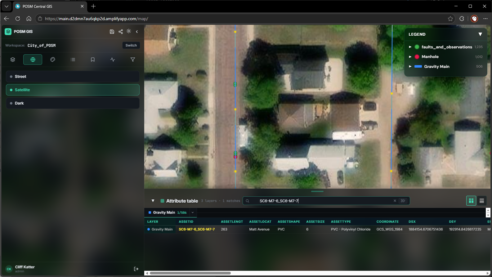
Enter an Asset ID, address, attribute, or other available value.
The Attribute Table displays matching records as the search is applied.
The number of matches is displayed above the table.
Know an Asset ID?
The Attribute Table search provides a quick way to locate an asset when you already know its Asset ID, location, or other identifying information.
For searches involving specific fields or multiple conditions, use Advanced Search.
Navigate the Map
Use the map to navigate through the organization's GIS network.
You can:
- Pan to another location
- Zoom in
- Zoom out
- Change the basemap
- Turn GIS layers on or off
- Search for assets
- Click mapped features to view their information
Use Bookmarks when you want to save a frequently used map view.
View an Asset
Click a mapped asset to open its information window.
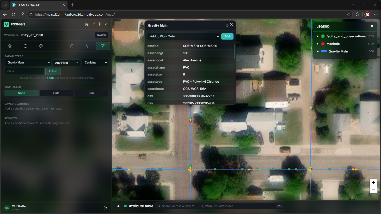
The information displayed depends on the selected GIS layer and the data stored for that feature.
For example, an asset may contain:
- Asset ID
- Asset length
- Asset location
- Asset shape
- Asset size
- Asset type
- Coordinates
- Start and end information
- Other GIS attributes
When available, the asset information window may also provide controls for:
- Opening an associated inspection report
- Adding the asset to a Work Order
Open an Inspection Report
When a GIS asset is associated with POSM inspection information, the asset information window may contain a report_link.
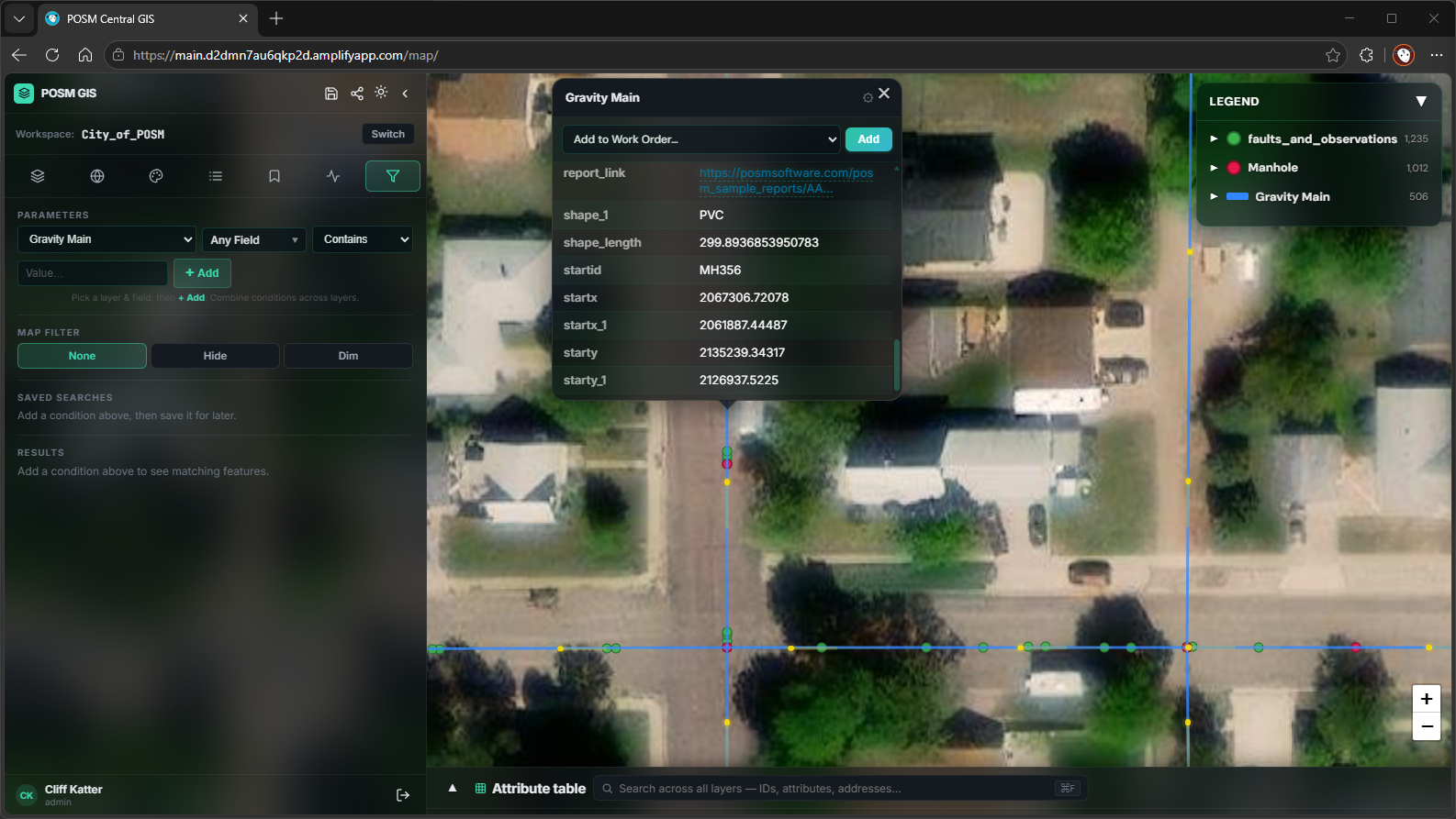
Click the report link to open the inspection reports associated with the mapped asset.
This allows you to move directly from a mapped GIS asset to its inspection information without manually locating the inspection in Session Management.
Save a Map View
Use Bookmarks to save a frequently used map location and return to it later.
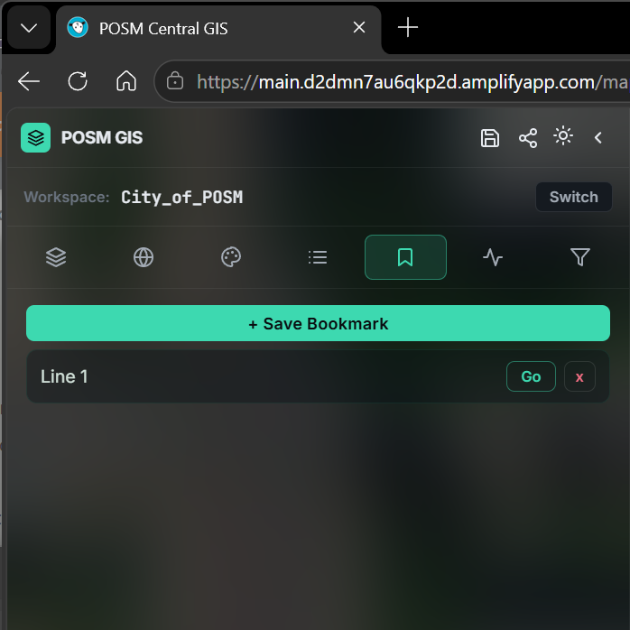
Pan and zoom to the desired location, select + Save Bookmark, and give the bookmark a name.
Saved bookmarks appear in the panel. Select Go to return to a saved view or the red X to remove it.
Advanced Search
Use Advanced Search when you need more control than the Attribute Table search provides.
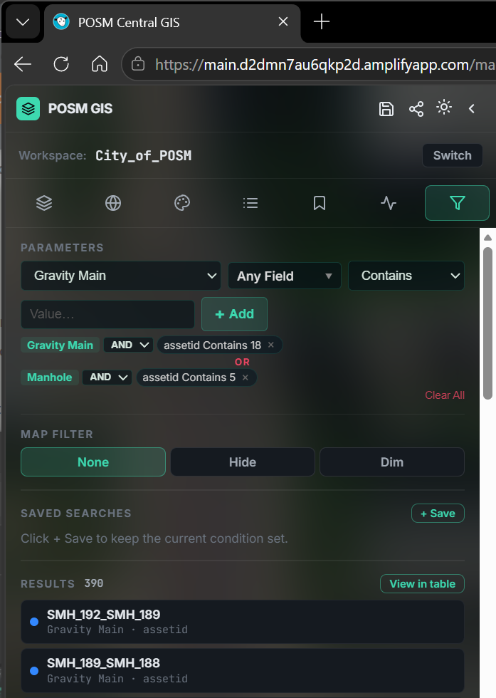
Advanced Search allows you to combine conditions using GIS layers, fields, comparisons, and values.
You can also filter the map, save frequently used searches, review matching results, and open the results in the Attribute Table.
Learn More About Advanced Search
Symbology and Flow Direction
Use the Symbology tab to control how GIS features are displayed.
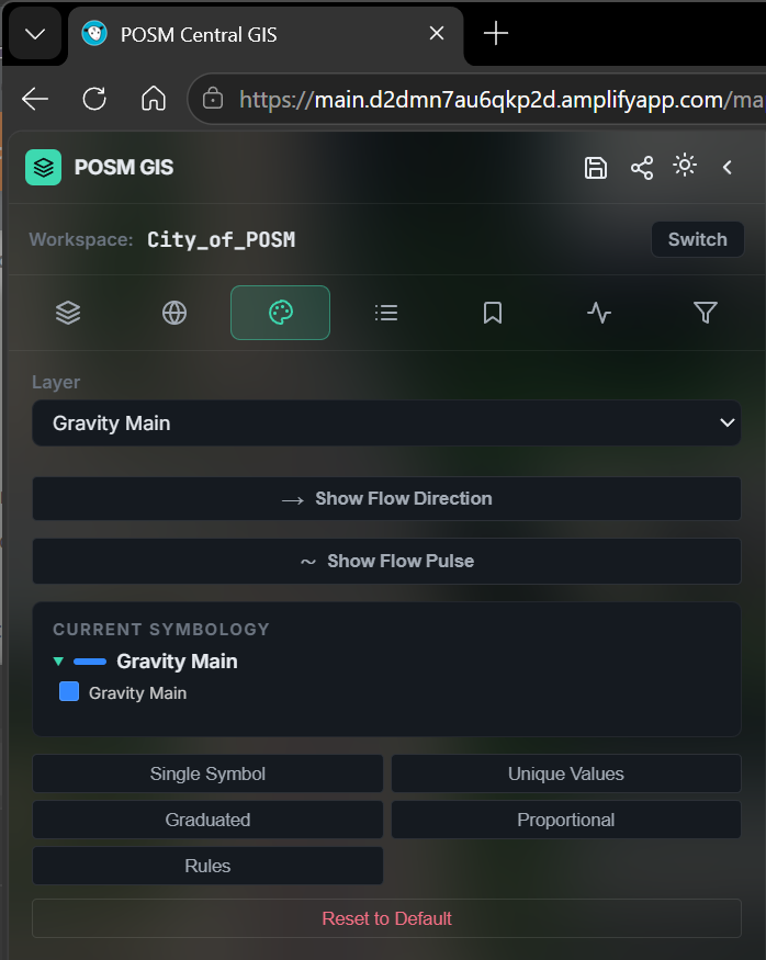
For applicable pipe layers, Show Flow Direction displays directional arrows and Show Flow Pulse provides an animated indication of flow direction.
Additional symbology controls are available for changing how GIS features are represented on the map.
Learn More About GIS Symbology
Work Orders
Use Work Orders to group GIS assets into field tasks.
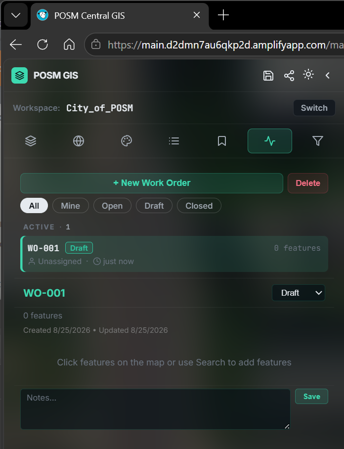
Create a work order and add applicable GIS features from the map. Work Orders can be used with POSM Map Reader (MR3) to provide selected GIS assets and related information to field crews.
GIS Data Depends on Your Organization
POSM Central GIS displays the layers and attributes configured for the organization.
Different GIS workspaces may contain different:
- Layers
- Fields
- Asset types
- Symbology
- Inspection information
- Work-order information
Because of these differences, examples shown in this help site may not exactly match the GIS data in your organization's workspace.
Explore More POSM Central GIS Features
The POSM Central GIS overview provides additional information about:
- Layer controls and settings
- Point clustering and feature labels
- Expanded Attribute Table
- Advanced Search and saved searches
- Work Orders
- Share Map View
- Saving your GIS setup
- Workspace switching
Need Help With POSM Central GIS?
POSM Support can assist with access to POSM Central GIS, map configuration, GIS data, report links, searches, Work Orders, or other GIS questions.
You do not need to diagnose the problem before contacting Support.